
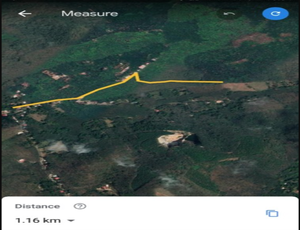
Land base Map on lines & polygons
Intergrated Water shed Management programs of ICIRISAT
Intergrated Water shed Management programs of ICIRISAT
Jalasamrudhi scheme aims at ensuring water security through conservation activities
The intergrated water shed management is using every drop of rain water by means of individual ponds or in large hectares of land
The outcomes are prevention of soil run-off, regeneration of natural vegetation, rain water harvesting and recharging of the ground water table. This enables multi-cropping and the introduction of diverse agro-based activities, which help to provide sustainable livelihoods to the people residing in the watershed area.
Water shed management programme are in kerala in taliparambu 66 crore and many south india state like in bellari district karnataka where mining was not the problems faced by the people , but declined in farming due to change in climate that increases the temperature by 2 degree Celsius and heavy rain and floods affected farming & cutivation of traditional Cropwz and for the development of farming ICIRISAT ( INTERNATIONAL CROPS RESEARCH INSTITUTE FOR THE SEM I ARID TROPICS ) plan to implement intergrated water shed management in bellari district Torangallu


Integrated Coastal Zone Management (ICZM) Consisting of boundaries , coastline , biodiversity, Natural hazards , population in Velankanni
Integrated Coastal Zone Management (ICZM) is integrating the coastline district that are open to sea threat , Tsurnami , soil erosion. Now Integrated Coastal Zone Management (ICZM) is implemented in west bengal , Orissa and Gujarath and many places of tamil nadu showing the coastline of 13 district of tamilnadu
Velankanni Aerial maps showing from Railway station on one side to the creek on other side of the Velankanni church premise

Market / Bus stand / Slums adjacent to Church

Aerial Sketching of Velankanni with different colors and line types

Velankanni church Land area

Building / roads between railway station and velankanni baslica

Shops and building surrounding velankanni facing the sea

Shops extending to the coastline sea

From Railway station to baslica

Integrated Coastal Zone Management (ICZM) & NATURE MADE SEA ISOBARS - Pithrody Udyavar Beach
Pithrody Udyavar Beach - Pithrody Beach In Karnataka Lies Between A River And A Sea. Udyavara River & Arabian Sea - In the small town of Udyavara, Udupi (Karnataka), you'll find the stunning Pithrody beach best explored on a drive upon a small stretch of road. It sits serenely between the Udyavara River on one side and the Arabian Sea on the other side
Pithrody Udyavar Beach - Mangalore Beach
The topography of the coastline is delta formation in coastline where a landscape seperate River and Sea. River on one side and Sea on other side in Mangalore beaches near Udupi
This isobar that seperate lake and Sea is having highway road that connect Matty and malpe beaches in Udupi coastline as this isobars in sea are naturally made


Intelligent flood warning system in Bangalore and waterlogging in underpass city roads
Intelligent flood warning system is giving the rain fall in each places of a town or city by placing warning devices in corners of the town as the rainfall may vary from place to place depending on the land base topology of the place with respect to other
Intelligent flood warning system is giving the rain fall in each places of a town or city by placing warning devices in corners of the town as the rainfall may vary from place to place depending on the land base topology of the place with respect to other
Waterlogging in a underpass and converting to a tunnel passage
Waterlogging in a underpass- the water level rises above danger level in the under pass roads as the two side of underpass is concrete wall and water cannot freely flow away due to no drainage .
The only way to over come it to convert the under pass to a tunnel model so as to avoid the water from entering the underpass road as it is converted to a tunnel model with roof like in tunnel
The roofing of the underpass and levelling the road with proper drainage will avoid rain way to flow inside the underpass that is now open with side wall that is collecting the water on the road in under pass now resulting road closing or buses to pass water logging roads
The roofing the underpass like a tunnel with concrete roof and the roof space over underpass roads gives space for parking over the concrete
2) roofing can be on metal sheets
3) PVC panels & steel panel roofing
4) solar panel roofing
As this roofing can be some distance, this can reduce water collection & logging in roads and indirectly the underpass roof space can be used for vehicle road side parking like elevated parking , children parks, gardens or solar power generation


Bangalore to pune is connected via three highway
1) via kholapur - satara- sangli route 842 km NH48
2) via solapur route 874 km NH48 & NH50
3) via Raichur route 950 Km
NHAI authority Pune to Bangalore Express highway project is expanding the NH48 at the cost of 40,000 crore and per km maxium 50 crore expense
Waterlogging had affected the project also. As reported In July, floods around the Kolhapur district led to an unprecedented closure of the crucial Mumbai-Bengaluru highway for almost four days.
The traffic on the national highway had come to a halt after the Panchaganga river swelled, after the heavy rains in the area.
According to locals, this was the first time the highway has been shut for three days in a row. At least 2,000 trucks and 1,000 private vehicles were stranded on both sides of the road: from Satara to Kolhapur and from Belgavi to Kolhapur.
This water logging can be overcomed by implementing water shed management that is useful for agriculture or diverting the highway via Solapur or raichur


Intergrated Flood Management programs of Disaster Management Assistant team (DMATs) & National Disaster Response Force (NDRF)
Kerala goverment is all prepared to face flood and heavy rain in kerala due low-pressure area over southeast Arabian Sea off Kerala coast, the state is expected to receive isolated heavy to very heavy rainfall with isolated extremely heavy falls till October 17
Kerala Rain Alert: Pathanamthitta, Kottayam, Ernakulam, Idukki, Thrissur are the districts where a red alert has been sounded and dams water level are rising as the most affected areas are high range areas
Kerala goverment will use helicopter to airlift people in disconnected place in sitwation of emergency by the hired helicopter and defense helicopter. The drones can also be used in search of people and Google Maps to sketch the flood affected places , flooded roads and railway line , airports and coastline
The Floods water are carrying lot of water and mud downstream & the sudden rise in water level in a place is due to building and boundaty walk in the path of the water ways like airport schools , college , industries , shopping complex is build with boundary wall around areas of land of a place , the water ways are blocked by this boundary walls and water level rises suddenly as water cannot flow away and no allow to build boundary walls on a acre of land that is creating floods in a place
Road accident will increase in flood watered roads as flowing water will wash away vehicles or make slippery roads making bikes to skid and fall causing injuries or death
The Dangerous soil erosion that capsizing house and building in the flash floods waters in river to downstream even in landslide or opening of dams in heavy rains
Flood water soil erosion are increasing due deforesting and cutting a large number of trees along the shores of lakes and rivers . Soil erosion the trees can prevent and not the building. As the rivers sides are not walled with concrete blocks, the soil erosion had made building to washed away along the soil due to soil erosion in floods , like the dams are build with high protection , dam water linked rivers side walls to build as the lower end of river sides with houses and no side walls
Kerala Roads transport is badly affected in the landslide , flash floods , waterlogging as the low pressure in Arabian sea is passing kerala shore from Lakshwadeep islands
Buses breakdown in flood waters are towing by rope and JCB inorder to save passenger from flood waters
The people from the buses says the roads are blocked and they got stranded due to heavy rains waterlogging and landslide in the near by towns, but the later landslide happen near to them carrying rocks and muds to the road and to their vehicles and No one was injured as the stranded people in buses and cars are moved to safer places by the highway police who passing this way at the time.

Soil Erosion by Landslide and opening of dams along the river shores taking away a double storied house

Kerala floods affect road transport network in high land area by Landslide and low land area by water logging


Road network in Land base aerial map

Sketching a Site

Location of a house in Google map

Road to a Site via the Google map
Total Land area of a Site


High Speed Railway line from Kochuveli in trivandrum to kannur
High Speed Railway in red line parallel to the old line

High Speed railway in red and the existing railway

Munnar Sight Seeing tour package from KSRTC kerala govt buses
KSRTC to conduct Munnar one night and one day tour trip from different KSRTC depots on kerala
KSRTC introduced new Munnar trip package from different dept of kerala that include with night stay at KSRTC bus station and Munnar sight seeing in KSRTC bus from morning to evening and by night the bus returns
The bus reach Munnar by 7 Pm and travellers can stay in accomodation provided in Munnar bus stand and morning sight seeing trip to evening and return bus will be on 9 Pm
The tour bus will on Saturday and return bus by Sunday night

Kerala Tourisam - Keravan Kerala
Kerala's Caravan Tourism policy 'Keravan Kerala', Bharat Benz & Autobahn Trucking Corporation rolled out its tourist caravan in the state for the tourism industry in Thiruvananthapuram on Tuesday.

Hill highway road from trivandrum to Kasargod
Finished parts
Kasaragod District - 23 km from Nandarappadav to Chewar (Rs 54.760 crore)
Kannur District- 59.415 km from Cherupuzha-Payyavur-Ulikkal-Vallithode (Rs 237.20 crore)
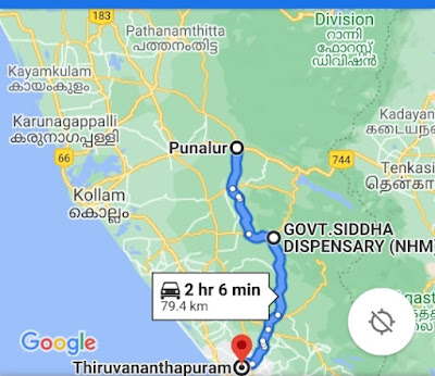
Kollam District - 48 km from Punalur to Madathara Kolayil (201.670 crore).
Districts requiring forest land
Kasaragod, Kozhikode, Wayanad, Malappuram, Thrissur, Ernakulam (Muvattupuzha and Ernakulam divisions), Idukki and Kottayam.
Structure
Total distance..1251 km
Expenditure ... Rs 3500 crore
Kasaragod District - 23 km from Nandarappadav to Chewar (Rs 54.760 crore)
Kannur District- 59.415 km from Cherupuzha-Payyavur-Ulikkal-Vallithode (Rs 237.20 crore)
Kollam District - 48 km from Punalur to Madathara Kolayil (201.670 crore).
Districts requiring forest land
Kasaragod, Kozhikode, Wayanad, Malappuram, Thrissur, Ernakulam (Muvattupuzha and Ernakulam divisions), Idukki and Kottayam.
Structure
Total distance..1251 km
Expenditure ... Rs 3500 crore
Trivandrum to Punaloor passing by the Madathata kovil
Pathanamthitta to Angamaly passing by kanjirapally

Punaloor to Angamaly pasding via konni - ponnkunnam

kanjirapally to Palghat passing by Munnar

Palghat to kasargod passing via chezupuzha

Comments
Post a Comment